

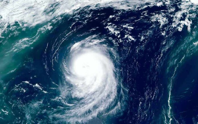
Hurricane Lowell, a Category 4 storm with winds near 150 mph, is forecast to pass dangerously close to Hawaii’s western islands late Monday night.
Story Snapshot
- Lowell is forecast to be near major hurricane strength when it moves close to the western Hawaiian Islands late Monday.
- Storm surge and wind impacts pose the biggest risk to Kauai County, forecasters say.
- Watches could be issued for the westernmost Hawaiian Islands as early as Saturday.
- Rainfall could top 10 inches on Kauai and the Big Island, with lighter totals expected on Maui.
Storm’s Path Takes Aim at Western Hawaii
The National Hurricane Center says Lowell is forecast to be near major hurricane strength when it moves close to the western Hawaiian Islands late Monday and Monday night. The storm has been moving west near 9 mph, and forecasters expect it to curve toward the northwest and then north over the weekend. That turn will decide how close the storm’s core actually comes to the islands.
As of the latest advisories, Lowell carried maximum sustained winds near 150 mph, putting it at Category 4 strength. The storm briefly reached Category 5 intensity earlier in the week before an eyewall replacement cycle weakened it slightly. Forecasters warned residents across the island chain to keep close watch on updates as the system’s exact strength and path continued to shift day by day.
Wind, Surge and Rain Threats Detailed
Forecasters flagged a real risk of storm surge and damaging wind, especially in Kauai County, as Lowell tracks toward the islands. Rainfall estimates are just as serious. Kauai and the Big Island could see 3 to 6 inches of rain, with isolated totals topping 10 inches. Maui is expected to get 2 to 4 inches, with pockets reaching as high as 8 inches, raising the chance of flash flooding in low-lying areas.
Marine conditions around the islands already reflect the storm’s growing influence. National Weather Service marine forecasts for the Honolulu region reported east-northeast winds of 20 to 25 knots and seas running 6 to 9 feet. Choppy surf and strong winds offshore often arrive well before a storm’s center gets close, giving boaters and coastal residents an early signal that conditions are deteriorating.
No Watches Yet, But Officials Urge Vigilance
Despite the intensity of the forecast language, no coastal watches or warnings were in effect at the time of the latest advisories. The hurricane center instead told Hawaii residents to monitor Lowell closely, noting that watches could be required for the westernmost islands as soon as Saturday. That gap between a serious forecast and no formal watch reflects standard hurricane center practice, not a downgrade in concern.
Forecast tracks issued earlier in the week already showed the storm’s westward drift before an expected turn toward higher latitudes, a pattern the hurricane center said remained consistent through subsequent updates. Uncertainty over the exact turn point means residents may see updated watches, and possibly warnings, added or adjusted through the weekend as Lowell’s position becomes clearer.
Hurricane #Lowell has reintensified into a category 5 hurricane as it continues west over the Central Pacific. At present time, Lowell poses no direct threat or impact to Hawaii. pic.twitter.com/HdtqaHiDtr
— Parker Weather Service (@PWXService) September 5, 2026
Lowell is the latest in a string of tropical systems to threaten Hawaii this season. NOAA’s seasonal outlook had put a 70% chance on an above-normal Central Pacific hurricane season this year, and back-to-back storm threats in recent weeks have kept island residents on edge. Whether or not Lowell’s core reaches land, the islands face real hazards from surf, wind, and rain in the days ahead.
Sources:
nypost.com, nhc.noaa.gov, forecast.weather.gov, foxweather.com