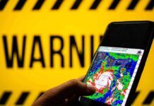


Edouard’s inland march swamped southeast Texas with dangerous rain and cut power to tens of thousands as flood risks grew by the hour.
Story Snapshot
- National Hurricane Center warned of 3 to 7 inches of rain, up to 12 inches in spots, with flash flooding likely.
- Local weather officials said the center moved inland and would track northwest, with scattered power and communication outages.
- Reporters on the ground confirmed flooded roads and widespread outages around Beaumont and Jefferson County.
- Regional counts climbed to more than 81,000 Texas customers without power by Tuesday night.
Heavy Rainfall And Flooding Threat Across Southeast And East Texas
National Hurricane Center advisories forecast 3 to 7 inches of rain, with isolated maximums near 12 inches from the Upper Texas Coast into east-central Texas. Forecasters said this rainfall would likely cause flash flooding, with significant flash flooding possible and some river flooding also possible as the storm tracked inland through Thursday morning. These warnings placed southeast Texas communities on alert for fast-rising water, street flooding, and swollen bayous and creeks as rain bands persisted overnight.
National Weather Service offices serving Houston and Galveston reported the storm moved inland along the northwestern Gulf Coast and would continue northwest through East and Southeast Texas. Officials warned of scattered power and communications outages as the system dragged deep tropical moisture inland. That path placed heavily populated corridors from Beaumont to the Houston metro under prolonged downpours, where drainage can struggle when rain rates spike over short windows of time.
Power Outages And Local Impacts In Jefferson County And Beyond
Reporters in Beaumont and Jefferson County described heavy rain, strong gusts, flooded streets, and toppled trees as the center passed nearby. One account reported about 42,000 utility customers without electricity in Jefferson County during the height of the push inland. Those on-the-ground snapshots aligned with the hazard profile forecasters laid out, where water and infrastructure disruptions often cause the most pain even as the storm’s wind speeds begin to ease over land.
Regional outage tallies rose into the evening as saturated soils and gusts stressed lines and poles. A widely watched weather service reported more than 81,000 Texas customers without power by Tuesday night as rain bands trained across the coastal plain. Exact peak numbers can shift as grids re-route and repairs begin, but the pattern was clear: the storm’s rain and wind combination knocked out service across pockets of southeast Texas while hampering travel and emergency response.
Storm Classification, Tornado Risk, And The Timeline Ahead
National Hurricane Center advisories labeled the system a tropical storm during parts of the Texas impact window, and later updates described a weakening depression inland. Despite the change in label, the hazards did not fade right away. Forecasters also flagged the risk for a tornado or two across southeast Texas and southwest Louisiana, a known threat in tropical rain bands that can spin up quickly and add to the danger near landfall zones.
First Alert: A Flash Flood Warning has been issued for southeast Polk county due to very high rainfall rates associated with Tropical Depression Edouard moving overhead.
This will impact Schwab City, Segno, Dallardsville, the Alabama Coushatta Tribe of Texas. #etxwx pic.twitter.com/2kG4pnqgA4
— Brad Hlozek (@KTREweather) September 2, 2026
Forecasters said heavy rain would continue into Thursday morning as the circulation moved farther inland across east and southeast Texas. That timeline matters for workers, first responders, and families trying to plan around flooded streets, power outages, and school or business closures. The broader Gulf Coast pattern holds here: water drives the largest impacts, while outages and road closures follow. Communities that clear drains, avoid flooded roads, and check on neighbors tend to bounce back faster after storms like Edouard.
Sources:
washingtontimes.com, accuweather.com, nhc.noaa.gov